A real finished sheet
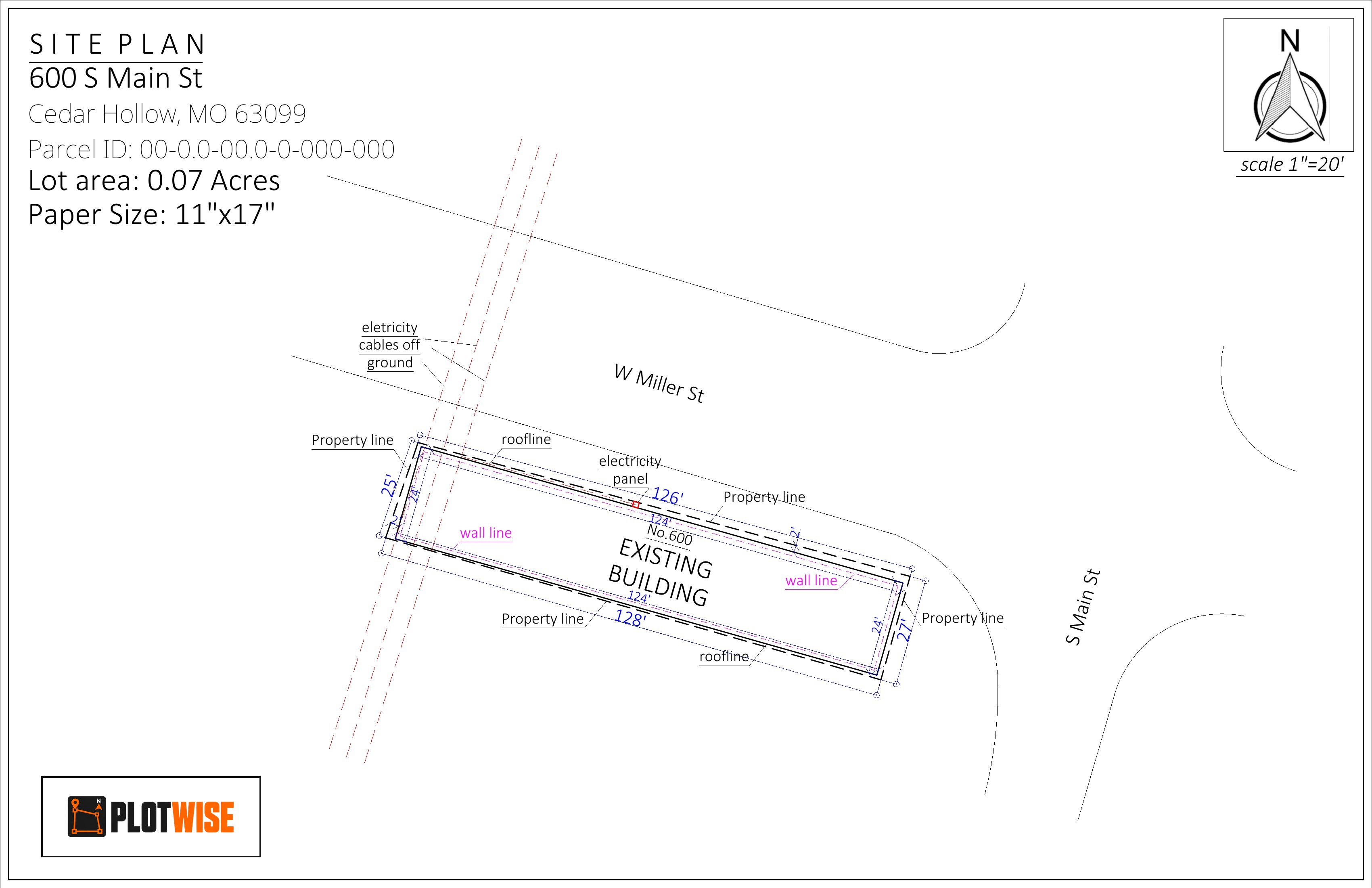
Below is a real 11×17 site plan for a small commercial lot, drawn at 1" = 20'. The city name and parcel number have been changed. Notice the information block at top left, the north arrow and scale at top right, every property line and wall line dimensioned, and utilities like overhead power lines called out with leader notes.
Property lines establish the site
The exterior boundary defines the lot being reviewed. Each segment should carry a length when the source information supports it. Street frontage, alleys, easements, and rights-of-way may also need labels.
Setbacks show the allowed offsets
Setback lines mark the required front, side, and rear distances you enter from local zoning information. They help reveal the buildable area, but they do not prove that a project complies with every zoning or building rule.
Existing and proposed work must read differently
The house and other existing features establish context. Proposed construction should be unmistakable through its label, heavier outline, hatch, or another line style that remains clear when printed in black and white.
Dimensions answer the location questions
Overall structure dimensions explain size. Offset dimensions to property lines and nearby structures explain placement. Reviewers may also ask for driveway width, utility separations, or other project-specific measurements.
North arrow and scale make the drawing usable
The north arrow orients the property. The written and graphic scale help reviewers interpret distance and provide a check if the sheet is printed at the wrong size.
The title block identifies the submission
A title block commonly includes the project address, owner, drawing title, sheet number, date, scale, and preparer. A legend defines symbols and line styles; concise notes call out information that cannot be shown graphically.